
Christopher Chase-Dunn
First Mate Dick: best buddy of the Captain, a self-employed husband
and father who makes investments and travels.
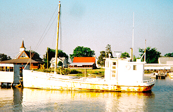
Dame Quickly: a 27 foot Pennant Class Sloop built on Long Island by Schneider in 1956; white cedar on oak frames, a 2 ton fin keel and v-bottom, a 16 horse auxiliary gasoline engine (Graymarine Light Lugger Four), a 36 foot solid spruce mast with a Marconi rig, a very large main sail and a jib club for the original small foresail, but also now sporting a genoa and a cruising spinnaker.
Garmin 45: a high tech gadget that tells you your longitude and latitude (within 150 yards) by means of contact with up to eight GPS satellites.
Autohelm 800: a 12 volt-powered automatic steering device with an internal compass. It attaches to the tiller and makes course corrections.
Various Others: Wives, children, mothers, colleagues, business associates and dead philosophers.
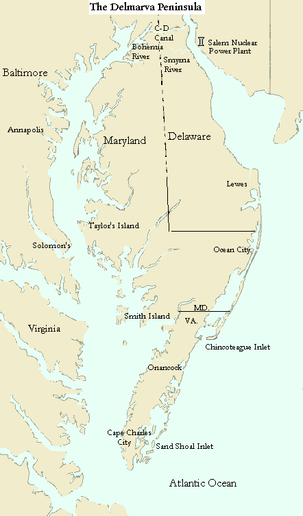
The old wooden boat is the tricky piece of this idea. The boat in question, now named Dame Quickly, was built forty years ago. A Pennant class sloop, she was high tech for her time with a vee hull and a fin keel. But the sail plan was pre-Bernoulli -- a large main and a tiny foresail. I spent ten years restoring her, working near the Hanover Street Bridge at the Baltimore Yacht Basin. She now has many new fasteners, new planks, new ribs, sistered ribs, and new keel bolts (except those under the engine). The stem is mainly original. The deck is new. The rudder is new. The restoration was thorough, but not total. And I have learned that a boat is a complex system. One little bad decision can send her to the bottom. Two dollars saved on a drain plug nearly lost her. I was nervous so I too-frequently charged the batteries to keep the pumps working. This caused the wiring to the bilge pumps to corrode. I used ring clips instead of cotter keys when I reassembled the rigging. The clips are more convenient when you need to take something apart. But they are not approved by marine surveyors for reasons that become clear below. Little things can cause calamity or disaster in a complex system in which everything relies on everything else. The boat was new and old at the same time. Would she hold up under the strains that wrack a sail boat in rough weather? Only sea trials would tell. And the real sea trial is at Sea, not in the Bay.
My wife Carolyn does not trust the Dame. The mast broke twice. The first time was in the boat yard while I was working on the timbers to which the chain plates were bolted. A thunderstorm brought a violent twister that ripped out the temporary nails that held the shrouds, and down she came. The second time was during my first shake-down cruise with Dick. We had the rail near the water tacking with the genoa coming out of Annapolis. I went forward to tighten the inner forestay. My shoelace snagged a ring clip that was holding the clevis pin on the bottom of a turnbuckle. One shroud of six was disconnected under load. The mast twisted and broke about six feet above the cabin sole. For the rest of that trip we were Dame Toothpick.
 an
artist's rendering of the boatyard
an
artist's rendering of the boatyard
I am now the last remaining Chesapeake expert at marine scarfs for solid wooden masts, having done the job twice. I cruised single-handed for a week the following summer without major mishaps, though my wife insisted on calling me Commodore Calamity. In the fall Carolyn finally agreed to accompany me on a weekend cruise. We were heading out of the Patapsco arm just past North Point in a fresh breeze when the old oak rudder came to pieces and left us without steering. This was the last straw for Carolyn.
I reasoned (hopefully) that the old rudder was the last weak link. Now it was replaced with stout mahogany and newly fashioned steel hardware replacing the old bronze. I deemed my craft ready for a true test -- rounding the Delmarva. My wife thought I was insane. She insisted that I draft a will before departure. My comrades at the boatyard assured me that it was no big deal. Captain Dan Davis, the proprietor of the Deadeye Saloon and master of the Baltimore Yacht Basin remembered his first time around the Delmarva at the age of 17 in an 18 foot motorless sail boat. Or perhaps it was a 17 footer and he was 18. My friend Lloyd Haag, an experienced skipper, had gone around in five days in his 36 foot Pearson. Another friend, Captain Glen Heaton, said I should avoid trying to tack in the ocean. He supposed that a pounding sea might not be good for my old hull.
The question arose as to whether to go clockwise or counter-clockwise around. In the spring and summer the prevailing winds are known to come from the south. One school suggested heading down the bay (into the wind) so that I could run back north in the ocean. Another school said that tacking in the ocean was preferable because of the greater seaway there. Captain Dan said he would wait to decide on the day of departure. He likes to sail with the wind whichever way it might be blowing.
I had also read, many years before, Robert DeGast's Western Wind, Eastern Shore, an inspiring account of the author's single-handed circumnavigation of the Delmarva in a small sail boat. I boned up on practical piloting techniques with Hewitt Schlereth's Commonsense Coastal Navigation. I also purchased a Garmin 45, a hand-held GPS, and practised with it on land. In addition to telling you your location, the Garmin records your track, provides an accurate estimate of your speed, and steers you toward designated destinations. This little wonder of modern technology proved its worth on the trip around. Dick wanted to sail and read and relax. He did not care much about conquering the Delmarva Peninsula. This led to a small, but significant, difference in the attitude of captain and mate regarding the hierarchy of goals for the trip.
There was not much wind as we turned down the bay toward Annapolis. I tightened the back stay with the oversized racing turnbuckle I had gotten for a good price at Mrs. Bacon's second-hand sail store in Annapolis. The backstay parted. I had pulled the swaged bronze eye-fitting out at the masthead. The whole rig is full of these bronze swages, all made in 1956. Were all the rest of them ready to give up too? Or was it just another case of bad fit between the new and the old? I used the sail and the boom to hold up the rig until we pulled into Annapolis harbor. After the sail was down I used the main halyard to support the mast from aft. It was a good thing the wind had been light that day. We tied up at the Chart House restaurant in Annapolis and had a nice dinner.
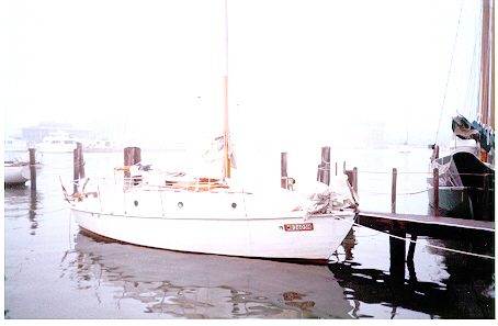 DQ
in Annapolis
DQ
in Annapolis
Saturday morning it was very foggy. We got gas and went to Fawcett's Marine Hardware, a famous Annapolis outfitter. They swaged a new eye on the backstay and I went up the mast in the bosun's chair to attach it. A passing sailor volunteered to belay the main halyard while Dick cranked me up with the winch at the base of the mast. I got the job done and we headed out. By 3 pm we were motoring into the wind near Bloody Point. We worked on the fine points of the Garmin 45: how to enter a route of waypoints and follow it. We adjusted the boat compass using the Garmin, but we were assuming that the Garmin heading was true rather than magnetic. Later we found out that the Garmin default setting is the magnetic heading.
My destination was Taylor's Island in the mouth of the Little Choptank. Dick was getting tired and he suggested that we should just go in "over there." He pointed to some adjacent land near Cooke's Point beyond the mouth of the Big Choptank. He had forgotten that Dame Quickly needs 4 feet of water to keep the keel off of the bottom. You can not just go in anywhere. I reminded him of the incident back in 1982 when we went aground trying to go into a harbor to get gas and were stuck for several hours. It was twilight as we entered the marked channel into Taylor's Island and it was very dark at 9pm as we slowly picked our way in to tie up near the honky tonk bar where the local folks were "sucking Rednecks" on Saturday night. For dinner we had leg of lamb barbecued over charcoal on the hibachi that I had rigged off the rear pulpit.
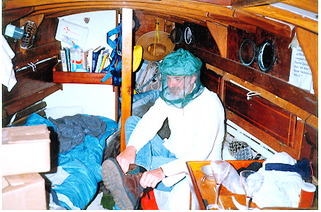 Dick
does not like mosquitoes
Dick
does not like mosquitoes
Next morning we took showers and photographed some of the work boats of Taylor's Island, and then we headed out. I anchored in shallow water near the bank of the channel so I could do some work on the hull while standing on the bottom. I needed to put the strainer cover over the engine-cooling water intake on the hull, a detail I had forgotten when the boat was out for bottom paint in Baltimore. The intake hole is hard to reach and it took quite a while to get the strainer on. We got stuck in the mud in an ebbing tide and had to wait for the flood to get off.
We finally got out of there at 3pm, sailing out of the Little Choptank closed-hauled with the cruising spinnaker. There was light air from the south and we ended up motoring down the bay toward the mouth of the Patuxent on the western shore. We adjusted the knotmeter using the Garmin 45, which gives your speed over the ground.
We rounded Drum Point at the mouth of the Patuxent River 30 yards from shore in 50 feet of water and arrived at Solomon's Island, our port for the night, at 8pm. We got gas after chasing around to find the gas man and then we anchored in a cove out of the main channel and finished the lamb. It was a pretty evening to watch the stars and the moon. I made a marine telephone call home to let Carolyn know where we were. In middle of the night we heard a clunk. The wind had changed and we had swung on our anchor into an adjacent sailboat. Luckily the wind was light and the occupants of the other boat were good-humored. We pulled the hook and moved further away from them.
At noon we developed engine problems. The clutch was slipping and the motor seemed to be starving for fuel. These events abruptly ended my philosophical quibbles. I changed the spark plugs and checked the fuel filter, but these interventions did not solve the problem. We changed course for the town of Ewell on Smith Island. I was worried about going in to Smith Island because the channel is narrow and not well marked. The locals all know the tricks and they laugh at ragtoppers who get stuck. The engine acted up and the depthfinder was giving weird and nerve-wracking readings (like 2 ft.), but we made it in OK. We arrived at the town dock at 3:30 pm. We passed a sign coming in that indicated displeasure with the Chesapeake Bay Foundation, an institution that has worked for decades on the preservation and restoration of the Chesapeake Bay. Last time I visited Smith Island Tom Horton, a famous author and bay conservationist, was running about in a skiff showing the wonders of nature to visitors. We overheard a waterman say sarcastically that he did not want to "harm the whales." The locals had developed an attitude.1
![]() At
the town dock in Ewell on Smith Island.
At
the town dock in Ewell on Smith Island.
We took a shower at the only motel in Ewell and had dinner at Ruck's - crabcake platters and ginger ale. I asked the proprietor at Ruke's about a local motor man who might be willing to have a look at my old Graymarine flathead. A phone call was made to Mr. Richard Evans and he promised to come in the morning. I worked on the motor after dinner, rebuilding the distributor (new cap, points and condenser). I disassembled the fuel pump to have a look-see and noted that the diaphram was badly worn. When I reassembled it I did not tighten down the cap well enough and now the motor got no fuel at all. Dick was helpful in figuring out what had gone wrong. We slept well tied up to the town dock and in the morning Dick made "Eggs Melange" with fine herbs provided by his dear wife Lisa. Lisa had packed a large box full of culinary delights, both home-made and purchased at an Italian gourmet provisioner's shop in Santa Cruz, California, where Dick and Lisa reside. This magic box of delights was to play a central part in our on-board meals to come.
In the morning Richard Evans came to look at the motor. An expert on these matters, he gave me some good ideas about the idiosyncracies of my old motor with its unusual updraft carburetor. Basically the answer for now was to open up the main jet on the carburetor. We got her running pretty well.
 An
old buy-boat at Ewell.
An
old buy-boat at Ewell.
And so we headed out down the bay. Now I was getting into territory where I had never been. We went past the graveyard of derelict ships that the Navy uses for target practice, around the south end of Tangier Island and across Tangier Sound into Onancock Creek. We sailed right up the river and into the nice old town of Onancock. After tying up at the public dock I noticed a big and worrisome leak in the corner of the transom. I removed some lag bolts to find that they were rusted and the wood they were bored into was rotted. We went into town for a fine dinner at the Hungry Duck restaurant.This colorful old colonial town has been discovered by urban refugees who are buying up and renovating the old homes and business properties. A local man told us about the arrow heads he had found out on Ware Point near the mouth of Onancock Creek and his notions about the indigenous people who once occupied this land. We called our wives after dinner to let them know we were still alive and still heading toward the ocean sea.
Next morning we took showers and went back into town for some carriage and lag bolts with which to fix the transom leak. We found an old hardware store stocked with everything you could want. I got some extra spark plugs for the motor and assorted other items, as well as the bolts. I used the lag bolts to drill holes through the transom and then installed the carriage bolts along with a healthy dollop of silicon caulk. This did not stop the leak but it slowed it considerably. By 12:30 pm we were out of Onancock Creek and headed down the bay toward Cape Charles City.
In light air I managed to get the cruising spinnaker halyard clipped to a shroud above the forespreader. I will have to go up the mast again to retrieve the halyard. We were getting well into the south bay now, unfamiliar and exciting territory. We sailed into Cape Charles City at 8pm.
This old town is a mostly-abandoned industrial port put out of business by the Chesapeake Bridge Tunnel that connects the Delmarva to mainland Virginia. Cape Charles City had once been the rail terminus where goods were transferred to boats and barges for the trip to Norfolk, Virginia. There are still tugs and industrial wharves, but rust is the most prevalent feature of the landscape. We tied up in the "Harbor of Refuge" where we met a sport fisherman who had spent the day out on the bay fishing for drum. The drum is a huge migratory fish that was now running up into the bay from the ocean. The fisherman showed us a 300 lb. fish in the bilge of his boat and told of the struggle to get this monster aboard. Then we went into town for dinner, but the only restaurant was already closed in the old, nearly abandoned, downtown area. We shopped at the local supermarket and were interested to hear Spanish spoken by other customers. Cape Charles City serves the farmworkers who spend their summers on Virginia's Eastern Shore.
We went back to the boat to cook dinner. Dick hoisted me up the mast to the point that I could stand on the lower spreaders to unhook the snap hook I was using to attach the halyard to the sail. This snap hook opens by pressure from the outside, which is how it had gotten clipped on an upper shroud. Another lesson learned the hard way: use shackles (or knots) on your halyards. Tomorrow was the day of decision: to go around or back up the bay. It had taken us six days to come this far, mostly against the wind. We still had seven days before I had to pick up my mother. The wind should now be more favorable. But we would be in the ocean. Could the old hull handle it? I put the radar reflector up on the back stay.
We got an early start out of Cape Charles City. Our plan was to sail out in the ocean and then to decide whether to go back into the bay or up the coast. Eldredge said the current would begin to flood at 11:15 am so we wanted to be out the mouth of the bay before then.We followed the red nuns around Cape Charles and Fisherman's Island as the man at the bait and tackle store in Cape Charles City had advised. It was a glorious day -- light wind from the north, sunny but not hot. We passed under the bridge and headed toward Nautilus Shoal, a shallow place that the bait shop owner had assured us was passable with our draft. We saw a line of foam on the surface in our path and as we approached it I was nervous. We sailed right over it in plenty of water.
A school of ten porpoises seemed to follow the boat for a while. It was a magic moment and Dick and I made the decision to go for it. I had promised to call Binnie Bailey, a colleague at work, when I got out in the ocean. So I contacted the marine operator and put in the call. Ms. Binnie was out of the office but Ms. Vonnie took the message. A school of twenty porpoises came bouncing toward us. We were excited about being on the ocean sea.
Now that we were well beyond the point of no return I teased Dick about having let me trick him into risking being eaten by the fishes. Nobody would be stupid enough to go out in the ocean in an old wooden sail boat designed for the bay. Only that silly debate about goals had allowed him to lower his guard and be swept away with the crazy notion of going around. He knew I was kidding.
The Garmin 45 was set to indicate the point at which we should head west into the inlet. We turned at the indicated point despite confusing visual information. I could not make out the inlet, though what appeared to be an abandoned barn could have been the remains of the Coast Guard station. I took down the sails and motored slowly toward the land. The boat slowed and the Garmin 45 began giving erratic locational readings, which it sometimes does when you are hardly moving. This is because the Defense Department introduces a random error into the satellite signals so that terrorists cannot use a GPS for precise orienting or for targeting. The depthfinder showed 7 feet and I was nervous. I did not want to go aground in the ocean and beat off my boards .
After several minutes that seemed like hours we crossed the bar and found deep water in the channel entering Sand Shoal Inlet. It became clear that the derelict structure was the remains of the abandoned Coast Guard station on Cobb Island. We motored past a day marker that was on the chart and headed south in behind Wreck Island. We anchored at 6:30 pm in a forlorn spot near day marker G227 in water deep enough for comfort, but out of the main channel. A small and pristine piece of Wreck Island was visible to the west back toward the ocean. This was not a very protected spot if the wind should whip up, but at least we had land between us and the ocean swells. We prepared dinner and did a little fishing, but no bites. The dinner was one of Dick's delights -- composed of canned goods, fresh vegetables and the various pleasures from Lisa's package. I was a bit worried about our location and the wind gusted to about fifteen knots from the south. Strangely, the clouds were coming from the west. It was a beautiful sunset. I hoisted the anchor light and we slept as the chop slapped against the cedar planks.
We were up early next morning, Friday May 24. Our ground had held all night and now the wind was about fifteen knots from the southwest. We breakfasted and hoisted the main and the genoa to sail out of Sand Shoal Inlet. It was fun as we headed north toward our destination, Chincoteague Inlet. We played "Twenty Questions" and Dick stumped me with something that was sometimes animal, sometimes mineral. It was a goal. Touche'. The wind shifted to the west and finally to the north, so we motored the last few miles to Chincoteague. The chart shows several hazards in the approach from the south -- breakers, shoals and wrecks. We motored past a breaker patch and noticed a fishing boat coming in parallel to the beach on the south end of Assateague Island. We followed the fishing boat to the entrance of the inlet and from there the channel was clearly marked. We had a bit of trouble once we were approaching the town of Chincoteague. We ran aground twice trying to go into Bob's Marina for gas. Finally Dick got on the marine radio to ask the Coast Guard where we could buy gas. They checked around and called back to "the vessel Dame Quickly." They told us we could get gas at the Chincoteague Inn, so we went there for dinner and fuel.While I was phoning home Dick came around the corner with a basket full of long meaty bones. The free appetizers were drum ribs, the most delicious sea food item I have ever eaten.
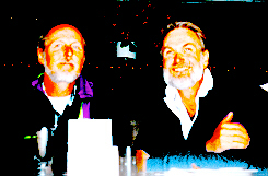 DQ
crew at the Chincoteague Inn.
DQ
crew at the Chincoteague Inn.
The following morning was cold and rainy. We had coffee and muffins at a small cafe in Chincoteague and shopped for a replacement for the switch for bilge pump number 2. The old one had fallen apart from corrosion. I wanted both pumps functioning before we headed back out to sea. Dick carefully plotted our course from Chincoteague to Ocean City and entered the way-points into the Garmin. His navigation skills with this little device were seriously out-performing my dead reckoning efforts. The Garmin had again proved its superiority coming into Chincoteague. We finally departed at 1:30 pm. With the wind from the north we sailed south out of the Chincoteague Inlet and reached east along the beach at the south end of Assateague Island. When we had gone far enough out, I headed up to try tacking in the ocean, the thing I had been cautioned against. There was a fifteen knot breeze and four foot seas. It was rough on my old hull as it came thumping down. I decided that it would be prudent to motor and had a difficult time getting the sails down. Even motoring into this was rough. The hull thudded a few times before I slowed her down. Dick and I put on our rubber pants and our life preservers. The Autohelm 800 worked well despite the rough seas and drenching spray.
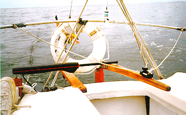 The
Autohelm 800 at work.
The
Autohelm 800 at work.
The wind slackened about 4 pm. We arrived at Ocean City inlet in the dark and tied up at the gas dock at 9:10 pm. We had a fine dinner at Harrison's Harbor Watch, an eminent restaurant overlooking the Ocean City Inlet. But the waiter had never heard of drum ribs. The next day I planned to make the run up to Cape Henlopen at the mouth of the Delaware Bay and into Lewes, Delaware, another fishing village. Dick requested that the First Mate be given the day off. He agreed to meet me in Lewes.
The next morning we had breakfast on board and showers at the place where we had tied up. Dick headed ashore and I got underway at 10 am. It was a sunny day with little wind. I motored out of Ocean City and headed north along the shore with my safety rope deployed. During earlier single-handed adventures I learned to precaution against losing the boat by dragging a twenty-five foot line aft. If I should fall overboard while working the sails I would be able to grab the line and pull myself back to the boat. It was a beautiful day. I sunbathed, fished and read as the Autohelm steered. By 3 pm the wind had come up from the southeast, so I put up the sails and turned off the motor. I was making four knots when I arrived at the Harber of Refuge light at Cape Henlopen and turned into the mouth of the Delaware Bay. I saw the Cape Henlopen-Cape May ferry heading out toward me and called on Channel 13 to find out her intentions. The Captain said "one whistle, port to port" and he swung east after he cleared the breakwater.
It was raining a little when I found Roosevelt Inlet, the channel into Lewes. My depthfinder was giving weird readings in the murky water. I motored slowly past fishing boats and yachts, and noticed an interesting traditional sail boat. As I passed the owner stuck his head out of a porthole to say "Lookin good." That was a nice moment. I tied up at a restaurant near the bridge in Lewes. Dick arrived about 9 pm.
After several hours and well up the bay, the wind calmed a bit. We shook out the reef and hoisted the jib.We called the Coast Guard to report a hazard to navigation in the main ship channel, a nearly submerged object that looked like a large boiler or tank. We could see the Salem Nuclear Power Plant up the bay. There were few boats of any kind on the Delaware that day. Our destination was the Smyrna River, a place to get off the bay that I had read about in Robert DeGast's account. The chart showed a marker indicating the entrance, but at the point the Garmin told us to head in there was no marker. We proceeded slowly and sure enough we found the small entrance to the Smyrna and a deep channel winding up through the high wetland grasses. In one of the widest spots we anchored as far from the middle as was possible. DeGast had written of the fleet of fishing boats that came charging down the river in the wee hours of dawn. I did not want to be in their way. We cooked another fine dinner in the cabin and lowered our cooking pot overboard for the crabs to clean, a technique suggested by DeGast. The lights from the cooling tower at Salem shone through the high grasses, and we slept well in the sheltered spot.
Next day it was still raining. The trick with the cooking pot did not work well. The line got tangled in the prop when the current changed. It was too cold for a swim, so I cut the line. We headed up the bay toward the entrance of the Chesapeake-Delaware Canal. Eldredge told us that the current in the canal would turn against us at 1 pm. We made good progress in the canal for a long way, sailing wing-and-wing with the genoa in a light air and the current in our favor. We passed only one ship, and saw the reason for all the warnings about staying out of the way and avoiding being hurled by a wake into the sea wall. The wind died and we motored into Chesapeake City. We got gas at the Schaeffer's Canal House restaurant. Now the current was against us. It took quite a while to get the rest of the way through the canal and into the Elk River branch of the Northern Chesapeake. It was good to be in familiar waters again. It had been raining all day and my hands were soaked. Dick was tired and had assumed that his services were no longer needed with the Garmin. Our destination was the Bohemia River, where we planned to anchor for the night in Veazey Cove. I was trying to read the chart in the fading light but got confused. The numbers on the channel markers did not correspond with those on the chart. I was not sure where I was. Finally Dick agreed to power up the Garmin. We found the Bohemia and Veazey Cove just as it was getting dark. This rain was getting us down. All our clothing was wet. We had dinner in the cabin once again and slept well despite a few leaks in the cabin sole.
Wednesday, May 29. I had to pick my mom up at the airport this very evening. Time to go to Baltimore. It was still raining but at least there was a decent wind from the northeast. I whiskered out the genoa and we made 3 1/2 knots down the bay. Dick was in the cabin. I was cold. But the familiar landmarks cheered me. Near Poole's Island I had gone below to warm up a bit. A tug came charging up the bay and the Captain blew his horn and warned that boats should have someone at the helm, or at least on deck. He was right, but I was cold. The wind fell as we came up the Patapsco and we motored the last couple of miles to arrive at the home slip at 5pm. At the Baltimore/Washington airport three hours later my mother found me asleep in a chair when she got off the plane. We did it.
References
DeGast, Robert 1975 Western Wind, Eastern Shore. Baltimore: Johns Hopkins University Press.
Horton, Tom 1987 Bay Country. Baltimore: Johns Hopkins University Press.
Schlereth, Hewitt 1982 Commonsense Coastal Navigation. New York: Norton.
White, Marion Jewett and Robert Eldredge White, Jr. 1996 Eldredge Tide and Pilot Book. Boston: White and White.